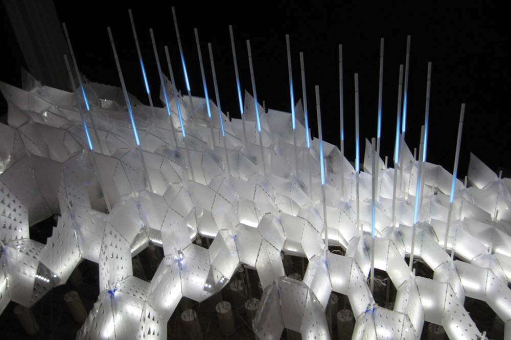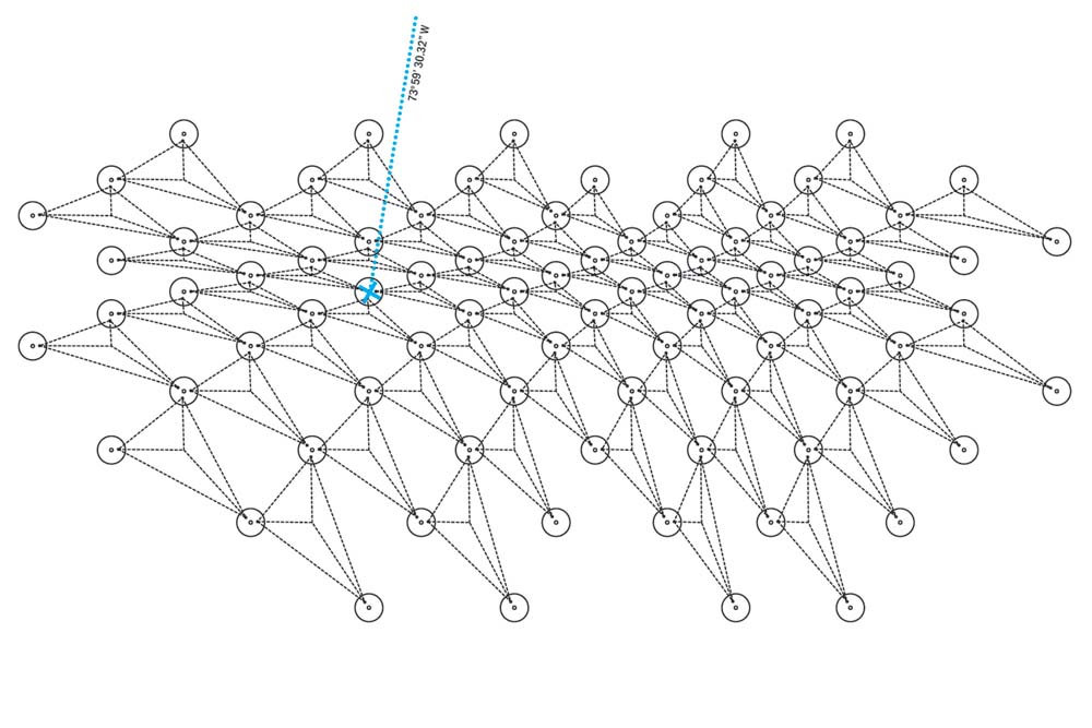
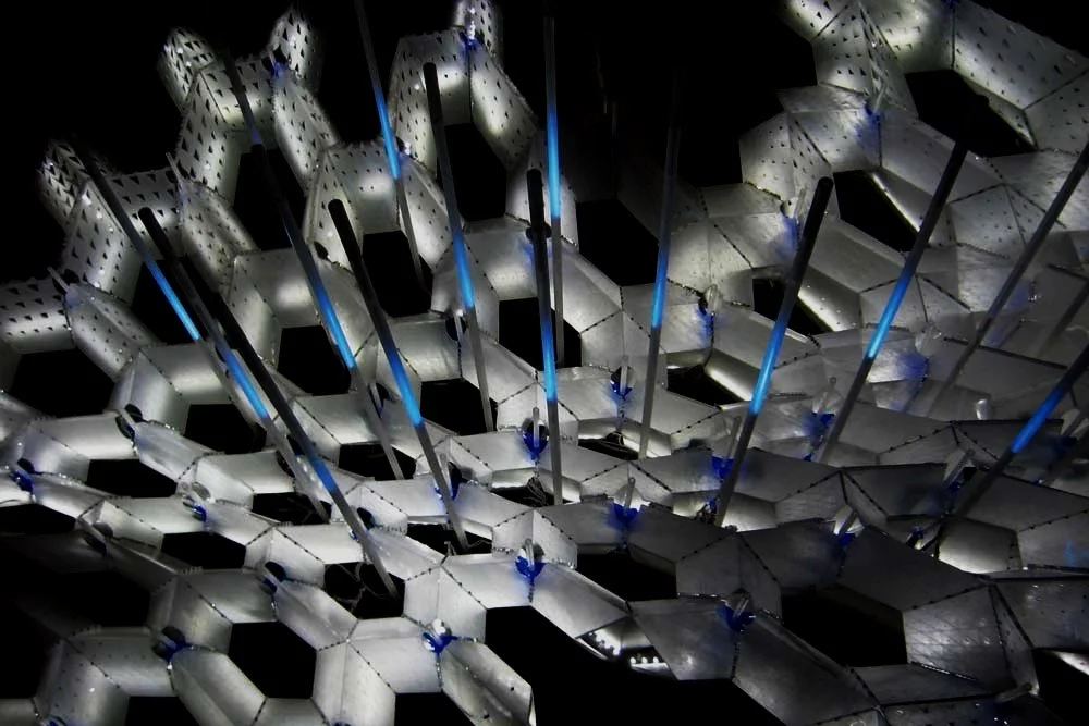
Aurora is an index of shifting territorial resources in the Arctic and a speculative vision for a massive new energy infrastructure and settlement pattern. Aurora suggests an alternative approach to the exploration, exploitation and eventual colonization of the region. It is simultaneously a projection of an imminent environmental condition, and the materialization of how contemporary political, social and ecological trends might be channeled towards a more productive future. The main interactive piece – the Aurora Model - superimposed the ephemeral qualities of these representations with the dynamic behavior of multiple users, translating the shifting dimensions of the ice into a responsive light field.
Date: 2009
Location: Van Alen Institute, New York, NY
Design: Jason Kelly Johnson & Nataly Gattegno
Team: Hank Byron, Taylor Burgess, Brad DeVries, Ben Fey, Paul Fromm, Sarah Fugate, Gin Harr, Thomas Kelley, Kyle Kugler, Carrie Norman, Kezia Ofiesh, Ed Yung, Jim Staddon, Yuki Staddon, Dayoung Shin, Kyle Sturgeon, Matt Young
Consultants: Noah Keating, Mathbeat industries (Interactive + Programming Consultant)
Support: The Van Alen Institute (NY Prize Fellowship in Systems and Ecology); The University of Michigan TCAUP (Research Through Making Grant) - Dean Monica Ponce de Leon, The University of Michigan Map Library; Graham Foundation for Advanced Studies in the Fine Arts Grant, Columbia University Avery CNC Fabrication Lab (David Kwon, Christo Logan, Nicole Seekely, Philip Anzalone - Assistant Director of Avery Fabrication); NYC College of Technology - CityTech @ CUNY (Carmen Trudell, Joseph Lim, Felix Baez)
Resources:
1. Sea Ice in Retreat (NYT Interactive Map 1/10/07)
2. If All the Ice Melted (National Geographic 11/13)
3. Sea Level Rise and Coastal Flooding Impacts (NOAA Website)
4. NOAA Coastal Services Center
5. USGS GIS Database (SF and other inundation specific data is here)
6. Arctic Ice Thickness maps